Utility Locating Specialists for over 30 years.
Underground Pipe, Cable and Utility Locating Sydney
Australian Locating Services – Utility Locating Specialists
ALS specialises in EM locating, GPR, non-destructive excavation, and surveying. Operating in Sydney, Newcastle, Wollongong and the Central West, we pride ourselves in going the extra mile and leaving no stone unturned.
Our expert team are Optus accredited and Certloc certified professionals, carrying out all of our projects in accordance with Australian Standards AS 5488.


We work with a range of customers from different industries including councils, builders, surveyors, architects, engineers, plumbers, electricians, and building consultants. Covering greater Sydney, Newcastle, Wollongong and the Central West.
For a competitive quote:
Personally Tailored Services to Every Client
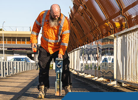
Utility Locating Specialists. Our professional and experienced team use a combination of radio frequency locating and ground penetrating radar to locate and identify underground pipes…
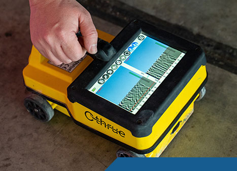
Concrete Scanning Specialists. We offer professional concrete scanning services using the latest GPR technology. Also known as concrete x-ray, GPR will locate utilities, conduits, steel…
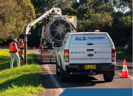
Damage free verification of your underground assets. Non-destructive excavation utilises high pressure water or compressed air to break up the ground…
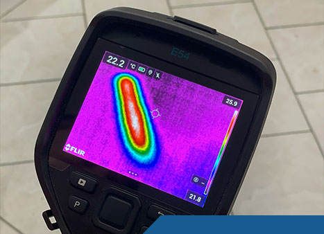
The most advanced leak detection technology and techniques. At Australian Locating Services, we understand how frustrating water leaks…
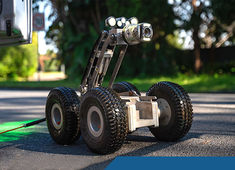
Hi-end CCTV tractor cameras and push cameras are used to carry out inspections on stormwater pipes, sewer lines, wells, shafts, and ducts…
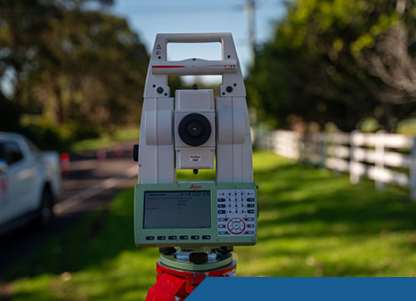
Reliable and Accurate Mapping of Utilities. Our team of surveyors provide comprehensive 2D & 3D surveying capabilities to assist with the location of marked utilities…
Why Work With Australian Locating Services?
30 Years of Quality Service
Covering greater Sydney, Newcastle, Wollongong and the Central West, we pride ourselves on providing the best service for our customers, always utilising the latest technology and over 30 years of experience.
Australian Standard AS5488
AS5488 is the Australian Standard for classifying subsurface utility information (SUI), improving the accuracy of locating underground utilities. It provides a framework for categorising data quality based on detection methods and confidence levels, helping to reduce risks in construction and excavation projects.
Tailored to Every Client's Needs
No matter the size of your project, our team will provide your business with the most accurate, efficient and cost effective asset locating solutions, every time.
Accreditations


Professional Affiliations


testimonials

Look forward to working with hime on more sites!!!

We can't recommend them highly enough.


Frequently Asked Questions (FAQs)
Frequently asked questions about utility locating and surveying services. Learn more by reading the FAQs below or contact us today.
What is an underground utility locating service?
An underground utility locating service uses specialized equipment—like electromagnetic locators and GPR underground utility locator systems—to detect and mark subsurface utilities before digging begins.
Why should I hire a cable and pipe locator?
Accurate locating avoids damaging buried services (like electricity, gas, water), preventing costly repairs, project delays, and safety hazards.
How does a GPR underground utility locator work?
Ground‑penetrating radar emits radio waves into the ground and records reflections when encountering changes in dielectric properties—ideal for mapping subsurface features.
Can it detect both pipes and cables?
Potentially—GPR detects both metallic and non-metallic ground anomalies, while electromagnetic locators work on conductive targets. GPR typically requires NDD for verification.
Is using a GPR underground utility locator safe?
Absolutely. GPR is a non-invasive and non-ionizing method, emitting only minimal energy—about 1% of a cellphone’s output.
What is an underground cable locator?
This is a tool using electromagnetic signals—either passive or active—to trace and map buried conductive assets such water pipes, electrical and communication cables.
What is an underground pipe location service?
A service that locates and maps gas, water, sewer or other pipes and cables underground using EM locators, GPR, and sometimes CCTV inspection and vacuum excavation.
What are common methods used by utility locating services?
Technologies include electromagnetic locators, GPR underground utility locator, vacuum excavation, CCTV, and 3D imaging mapping.
What degree of accuracy can be expected from a cable and pipe locator?
Professional operators, under AS5488 can achieve up to +/-300mm horizontally and +/-500mm vertically with an EM locator, this is called Quality Level B. There is no set tolerance for GPR. Higher accuracies, +/-50mm both horizontally and vertically, can be achieve by NDD, this is called Quality Level A.
Why is an underground service locate important for residential projects?
It helps homeowners avoid disrupting underground cables or pipes during landscaping, fencing, pool prep, or trenching—preventing damage or outages.
How deep can GPR scan underground utilities?
Penetration depth varies greatly depending on soil conditions and antenna frequency; ideal in dry sandy soil (up to ~5-10m), but reduced in wet or clay-rich grounds.
Can the service differentiate between rebar and conduits?
Yes — modern GPR concrete scanning systems can distinguish between metallic rebar and non-metallic conduits through signal characteristics.
What does 3D imaging add to utility locating?
It reconstructs multiple GPR scan lines into a 3‑dimensional view, enabling subsurface modelling for precise construction project planning.
What is safe excavation, and how does utility locating help?
Safe excavation avoids damaging utilities. The 5P’s of Safe Excavation from Before You Dig Australia (BYDA) should always be followed.
Plan
Plan ahead by lodging your BYDA enquiry at least one business day before your project begins, and ensure you have the correct information required to carry out a safe project.
Prepare
Prepare by reviewing the utility plans and contacting the asset owners if you need assistance. Look for onsite asset clues such as pit lids, marker posts and meters. Engage a skilled locator who can assist you in locating assets electronically before potholing.
Pothole
Pothole, if permitted, using the asset owner’s stated method as specified on the plans and information pack. Some potholing methods include hand digging or hydro vacuum extraction.
Protect
If potholing has occurred, protect the infrastructure by using various methods; such as communicating to all working on site, erecting barriers and / or marking the location of the exposed infrastructure.
Proceed
You should only proceed with your excavation work after you have planned, prepared, potholed (unless prohibited) and have protective measures in place.
Can private companies locate utilities on private property?
Yes. Public “Before You Dig Australia” services only display assets of their members, there may be other asset owners in the area. For secondary on-site underground services and confirmation, private locators are essential.
What does a construction project need in terms of utility locating?
Prior to site works, you need comprehensive locating (cables, pipes), depth data, 3D imaging, mapping deliverables to support design and compliance.
What limitations should I know about GPR?
Performance may be poor in conductive soils (e.g. clays), rocky terrain, or heterogeneous materials—so clear pre-assessment is crucial.
What value does a utility locating service bring to budgeting?
It avoids unexpected utility strikes, insurance premiums, and rework—saving time and money for residential and commercial builds.
How long does a typical locate take?
Durations vary by site size and complexity—from under an hour for small residential yards to several hours or more for larger construction project zones.
How are buried utilities marked?
Locators apply color-coded paint, flags, GPS coordinates, and images on-site and include mapping in final reports.
Is vacuum excavation part of locating?
Yes. Vacuum (hydro) excavation is a non-destructive excavation technique used to physically expose utilities identified by EM or GPR.
What deliverables come with a locate?
This varies based on request and purpose. Output and include maps, CAD/GIS files, depth data, survey coordinates, 3D models, and reports—tailored for safe work permit compliance.
How do I “locate underground utility” lines on my property?
Contact a certified locator, present site details, schedule a visit—then the team will perform EM and GPR scans before excavation.
Can utility locating help detect leaks or pipe damage?
Yes. Combined tools (e.g. acoustic leak detectors and CCTV) can locate pipe faults and map issues for targeted remediation.
Does utility locating comply with Australian standards?
Yes—professional locators follow AS 5488 classification, Before You Dig Australia (BYDA) protocols, and local regulations for safe, compliant excavation.
What is the difference between BYDA and DBYD?
DBYD (Dial Before You Dig) is now called BYDA (Before You Dig Australia). It’s the same referral service, just rebranded. BYDA provides plans but not on-site underground utility locating services.
Our Clients


